

• 4" dual-orientation, glove-friendly touchscreen display
• 5 MP autofocus camera
• 3-axis compass with barometric altimeter
• Uses rechargeable lithium-ion battery pack or AA batteries
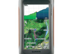
Take it hiking. Take it hunting. Take it on the water. Montana 650 features a bold 4" color touchscreen dual orientation display and supports multiple mapping options like BirdsEye Satellite Imagery and it has a 5 megapixel camera to boot. Montana has key features for the outdoors such as a 3-axis tilt-compensated compass and barometric altimeter. Buy the auto mount and a City Navigator NT® map and it'll give you spoken turn-by-turn driving directions.
Montana 650 features a vast 4", sunlight-readable touchscreen display that offers crystal clear enhanced colors and displays high-resolution images. It’s easy-to-use interface means you’ll spend more time enjoying the outdoors and less time searching for information. Both durable and water resistant, Montana 650 is built to withstand the elements. Bumps, dust, dirt, humidity and water are no match for this rugged navigator. No matter the setting — on the boat, in the RV or on an ATV — Montana is right at home.
Specifications for the Garmin Montana 650
Physical & Performance |
|
| Physical dimensions | 2.9" x 5.7" x 1.4" (7.48 x 14.42 x 3.64 cm) |
| Display size, WxH | 2"W x 3.5"H (5.06 x 8.93 cm); 4" diag (10.2 cm) |
| Display resolution, WxH | 272 x 480 pixels |
| Display type | bright, transflective 65k color TFT, dual-orientation touchscreen; sunlight readable |
| Touchscreen | ✓ |
| Weight | 10.2 oz (289 g) with included lithium-ion battery pack; 11.7 oz (333 g) with 3 AA batteries (not included) |
| Battery | rechargeable lithium-ion (included) or 3 AA batteries (not included); NiMH or Lithium recommended |
| Battery life | up to 16 hours (lithium-ion); up to 22 hours (AA batteries) |
| Water rating | IPX7 |
| High-sensitivity receiver | ✓ |
| Interface | high-speed USB and NMEA 0183 compatible |
| Camera | yes (5 megapixel with autofocus; automatic geo-tagging) |
| Barometric altimeter | ✓ |
| Electronic compass | Yes (tilt-compensated 3-axis) |
| Unit-to-unit transfer (shares data wirelessly with similar units) | ✓ |
Maps & Memory |
|
| Basemap | ✓ |
| Ability to add maps | ✓ |
| Built-in memory | 3.0 GB |
| Accepts data cards | microSD™ card (not included) |
| Custom POIs (ability to add additional points of interest) | ✓ |
| Waypoints/favorites/locations | 4000 |
| Routes | 200 |
| Track log | 10,000 points, 200 saved tracks |
Outdoor Features |
|
| Automatic routing (turn by turn routing on roads) | Yes (with optional mapping for detailed roads) |
| Geocaching-friendly | Yes (Paperless) |
| Custom maps compatible | ✓ |
| Hunt/fish calendar | ✓ |
| Sun and moon information | ✓ |
| Tide tables | Yes (with optional Bluechart) |
| Area calculation | ✓ |
| Picture viewer | ✓ |
Garmin Connect® |
|
| Garmin Connect™ compatible (online community where you analyze, categorize and share data) | ✓ |