

• 3" sunlight-readable touchscreen display with dual orientation
• 8 MP autofocus camera with LED flash/torch
• Worldwide basemap with shaded relief
• 3-axis compass with accelerometer and barometric altimeter sensors
• Dual battery system — 2 AA batteries or included rechargeable internal NiMH pack
With high-sensitivity GPS and GLONASS satellite tracking, worldwide basemap with shaded relief and customizable buttons for 1-touch image capture and waypoint marking, Oregon 650 opens a new world of GPS mapping and positioning.
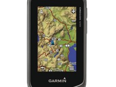
Oregon 650 has reflective display technology for the most brilliant, sunlight readable touchscreen we’ve ever made. It's as vivid in full bright sunlight as it is in shade. The screen has been strengthened for impact resistance but still accommodates gloved operation. And with dual-orientation, multi-touch screen, you won’t just look at maps, you’ll interact with them when you zoom in, pan out and rotate the display.
Specifications for the Garmin Oregon 650:
Physical & Performance |
|
| Physical dimensions | 2.4" x 4.5" x 1.3" (6.1 x 11.4 x 3.3 cm) |
| Display size, WxH | 1.5"W x 2.5"H (3.8 x 6.3 cm); 3" diag (7.6 cm) |
| Display resolution, WxH | 240 x 400 pixels |
| Display type | transflective color TFT touchscreen |
| Touchscreen | ✓ |
| Weight | 7.4 oz (209.8 g) with batteries |
| Battery | rechargeable NiMH pack (included) or 2 AA batteries (not included); NiMH or Lithium recommended |
| Battery life | 16 hours |
| Water rating | IPX7 |
| High-sensitivity receiver | ✓ |
| Interface | high-speed USB and NMEA 0183 compatible |
| Camera | yes (8 megapixel with autofocus; digital zoom) |
| Barometric altimeter | ✓ |
| Electronic compass | Yes (tilt-compensated 3-axis) |
| Unit-to-unit transfer (shares data wirelessly with similar units) | Yes (plus images and custom maps) |
Maps & Memory |
|
| Basemap | ✓ |
| Ability to add maps | ✓ |
| Built-in memory | 4 GB |
| Accepts data cards | microSD™ card (not included) |
| Custom POIs (ability to add additional points of interest) | ✓ |
| Waypoints/favorites/locations | 4000 |
| Routes | 200 |
| Track log | 10,000 points, 200 saved tracks |
Outdoor Features |
|
| Automatic routing (turn by turn routing on roads) | Yes (with optional mapping for detailed roads) |
| Geocaching-friendly | Yes (Paperless) |
| Custom maps compatible | ✓ |
| Hunt/fish calendar | ✓ |
| Sun and moon information | ✓ |
| Tide tables | ✓ |
| Area calculation | ✓ |
| Picture viewer | ✓ |
Garmin Connect® |
|
| Garmin Connect™ compatible (online community where you analyze, categorize and share data) | ✓ |